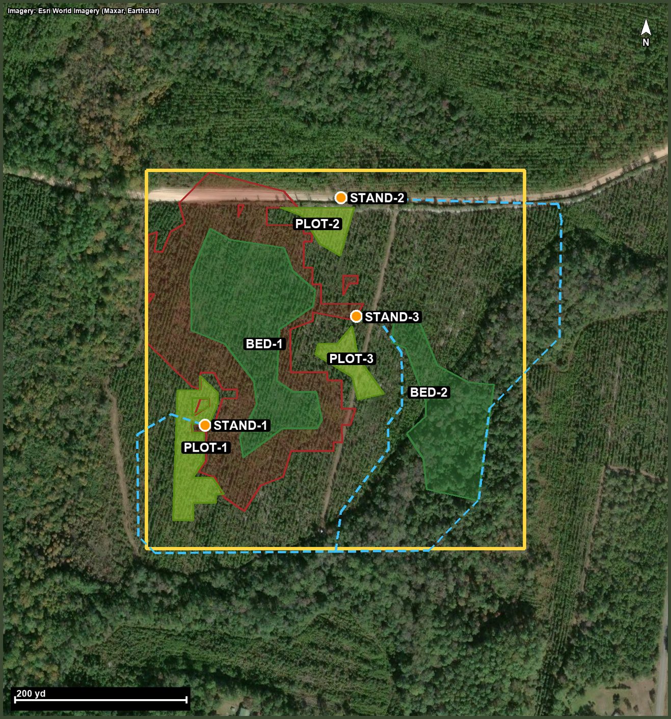
I.Plans your property
A habitat consultant charges $1,500 to $2,500 a day and books out
seasons ahead. Deer Camp builds your plan from the same raw material
they use, in about a minute, and you can run it again on every new
piece of ground you pick up.
II.Maps your camp
Stands, cameras, scrapes, rubs, feeders, gates, and parking, marked by
any member and seen by all of them, with a note on who put it there.
Hang a picture on a stand so the new fella knows the view before he
climbs in at five in the morning.
III.Learns your deer
Hand it your trail cam pictures and it reads them: what deer, how
many, the time off the stamp, and the wind that hour. Enough pictures
and it shows you the travel lanes on your map, which cameras earn
daylight, and a hunt forecast scored against your own stands. It knows
your state's rut dates and season windows, and when it doesn't know
something, it says so and tells you what to go check.
IV.Works in the woods
Save your property to your phone before you leave the house and the
map keeps working where the bars quit. The GPS dot walks you to your
stand in the dark. Add it to your home screen and it opens like any
other app.
No guesswork and no magic. The plan is built from public
survey data most folks never touch, read the way a land manager reads it.
Tap your ground
Drop a pin and your boundary comes up from the county records. Leased
ground or a hand-me-down survey? Trace the corners yourself in a minute.
Let it work
The terrain, soils, cover, and wind get read together and turned into
a full plan while you pour a cup of coffee.
Put it to use
Open the map, print the plan, plant the plots, hang the stands, and
hunt the right wind. Invite the camp with one code.
Does it work on leased ground?
Yes sir. If the lease follows the parcel lines, tap it. If your lease
is a piece of somebody's bigger tract, trace your corners on the
satellite view and the plan runs on exactly what you drew.
What states does it cover?
The whole lower 48. The terrain, soils, and boundary data are national.
It was built and proven on flat south Georgia pine and swamp ground
first, which is the hardest kind to read, and it works just as well on
midwest hills.
Do I need cell service at camp?
No. Download your property while you're on wifi and the map, your
marks, and the GPS dot all keep working with no signal. Photos and new
marks sync back up when you do.
Who can see our club's pins?
Only members of your camp. There's one invite code and you decide who
gets it. Nothing about your property or your stand locations is public,
and we don't sell data to anybody.
Is the plan as good as hiring a consultant?
An honest answer: a good consultant walking your ground will catch
things no map can, like browse pressure and a neighbor's bad habits.
The plan gets you the eighty percent that's in the terrain, dirt, and
wind, for about the cost of a bag of seed, and it tells you plainly
which calls to verify on foot before you cut or plant.
What's it cost?
Your first property and its full design are free, along with the map,
your marks, offline, sit logging, the movement patterns, the rut
calendar, and the hunt forecast, for good. Deer Camp Pro is $99 a
year or $9.99 a month per hunter and adds more properties, design
re-runs, the full week's hunt forecast, travel lanes drawn on your
map, buck gameplans, consultant-grade written plans, trail cam photo
reading, Ask about your ground, and one-tap boundaries from county
records.
No card to start, and nobody in your camp has to be Pro for you to
be.